
Engineering Independence: The Tech Behind Virtual Guide Dogs
For many, independent mobility is the ultimate goal. While traditional guide dogs and white canes have been the gold standard for decades, a new generation of assistive technology is emerging. At Red Nought, we are developing Virtual Guide Dogs, an intelligent system designed to bridge the gap between complex surroundings and safe, independent movement.
But what is the technology behind this, and how does it actually guide a user through the world?
The Two-Layered Navigation Strategy for Virtual Guide Dogs
We don’t treat the environment as a static image. To be truly effective, our software operates on two distinct, hierarchical layers of intelligence.
1. The Global Map (Campus-Wide Navigation)
Before a user takes their first step, the system understands the architecture of the building. This "Top-Level Navigation" treats the environment as a series of connected nodes.
The Process: The system identifies doorways and plots the most efficient path from one room to the next. It acts as the "Global Planner," ensuring the user is always moving toward their ultimate destination without getting lost in the "noise" of the immediate surroundings.
2. The Local Map (Dynamic Room Mapping)
While the Global Map handles the route, the Room Mapping handles the safety. This is the dynamic, real-time layer that ensures the user can move confidently through a space.
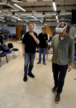
How it "Sees": To build this system, we are currently utilizing the Meta Quest 3 as our primary development platform. Its high-resolution cameras and robust depth-tracking sensors are essential for our depth-raycasting algorithms.
Floor Detection & Obstacle Avoidance: The software constantly calculates the distance to every object in the room. By analyzing this data, the system identifies the "floor plane." If an obstacle like a chair or a bag enters the path, the floor plane is effectively "broken" in the software’s mind.
Real-Time Adaptability: Because the system is constantly scanning, it is highly adaptive. If an obstacle is moved, the software detects that the floor plane has been restored and immediately clears the path, allowing the user to continue on the most direct route.

Why This Matters
By separating these two tasks, Global Navigation (getting through the door) and Local Mapping (avoiding the immediate obstacle) we create a system that is both reliable and responsive. It doesn't need to "re-learn" an entire building every time someone walks past you; it simply adjusts its local path in real-time.
Building the Future of Navigation: Join the Conversation
Our work with depth-raycasting and room mapping is just the beginning of our mission to redefine personal independence. We are currently scaling our navigation engine and seeking partners and investors who share our commitment to transformative, human-centric technology.
How we can connect:
See the Prototype in Action: We’ll be hosting a live demonstration of our latest navigation technology at the 'See Hear Remember' event on June 16th, organised by Sight Loss Shropshire. We invite you to join us to experience the tech firsthand and discuss our roadmap for the coming year. https://sightlossshropshire.org.uk/events/see-hear-2026/?occurrence=2026-06-16
Explore Partnership Opportunities: If you are interested in discussing the future of our software, investment inquiries, or collaborative opportunities, let’s start a conversation. You can reach our team directly at info@rednought.com.
Comments